<img alt="" src="https://secure.smart-company-365.com/266006.png" style="display:none;">

Product release center

At IQGeo we are listening to the needs of our customers and constantly enhancing our products. This product release center contains a summary of enhancement highlights from our most recent products releases.


See the current releases below and complete the form to access the more detailed release notes.

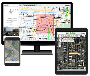
IQGeo_geospatial_productivity_and_collaboration_desktop_and_mobile

Current releases 

Network Manager Telecom 2.6

Comsof Fiber integration and more

  1. Comsof Fiber integration - Network Manager has been updated to include a built-in integration of automated planning and design.
  2. Path Finder tool - Users can now find automatically identify available paths from user-defined start and end locations.
  3. UX enhancements - It's now easier to add aerial and underground structures to the map as well as easier to distinguish new or existing spliced fibers.

Network Manager Electric 2.1

Enhanced as-built productivity

  1. Extended Point & Span Wizard - Users have support for hierarchichal modeling and can quickly create downstream segments.
  2. Added circuit objects - Users can now create savable/searchable circuit objects, such as feeders, so they can easily visualize sub-networks within the larger grid.
  3. Improved markup tool - Field users can add additional annotations, photos, points, lines and text in designs or as-built changes.

Comsof Fiber 23.1

Reporting and optimization

  1. New Report Module - Users can automatically generate graphical splice schemes, tabular splice reports, microduct connectivity reports and drawings.
  2. Aerial design improvements - A new algorithm allows users to mix underground and aerial connections in a single cluster.
  3. Additional underground drop options - Users can drop points on the same side of the street and cluster between junctions.

Inspection & Survey 5.2

Ticket and shift functionality

  1. Assign existing features to a new ticket - Users can select features on a map, such as cables or poles, and create a ticket that includes the geometries of those features.
  2. Create tickets from the field - Field Techs can now create tickets, start and end their shifts, and filter by ticket type. 
  3. Improved shift management - Through a new Admin Interface, users can quickly edit shifts, add and remove users, and generate status reports. 

Workflow Manager 2.1

Usability improvements

  1. More intuitive user interface - Users can save time by opening directly to the function needed.
  2. New ticket manager interface - Users can easily create new ticekts, assign tickets, search by ticket, or track hours. 
  3. Assign tickets from the field - Field Techs can now create tickets, start and end their shifts, and filter by ticket type. 

IQGeo Platform 6.5

Enhanced productivity and interoperability

  1. Improved vector rendering – Vector layers render much faster with less load on the server.
  2. Forms advancement – Save time with reduced clicks and scrolling along with auto-fills.
  3. Add multiple geometries to a feature – Super users can now add geometries to any feature without command line access.

Platform 6.4

Enhanced productivity and interoperability

  1. Bulk edit of features – Users can now update multiple features in a single action.
  2. Import/export DXF – Save time in design and permitting by importing DXF files into designs.
  3. Editable feature types by role – Users can now control which roles have the ability to edit features.

IQGeo Inside 2.1

Enhanced design workflows

  1. Configurable user design groups – Create and manage user groups that inherit various permissions across design jobs.
  2. Points and Spans Wizard – Allows users to quickly design and inventory the addition of new facilities on the electrical grid in one streamlined workflow.
  3. New Design Reports – Quickly view and export important details from their electrical designs, including an audit history for each object that was edited and a full bill of materials inventory report for compatible units.

IQGeo Inside 2.1

New features

  1. Product architecture – UWB is now using a current Edge Chromium as render engine. This improves performance and solves several issues. 
  2. Smallworld GIS support  – Added compatibility up to current Smallworld GIS version 5.2.9.
  3. IQGeo Platform integration – IQGeo Platform 6.2 is now supported.

Inspection & Survey 5.1

Map rotation and usability

  1. Inspection enhancements –Inspections are no longer features made during surveys but are instead their own concept mirroring surveys. 
  2. Crew creation integration  – User are now pulled from the Platform and/or LDAP to be used in crew creation.
  3. UI enhancements – The user interview has been given a facelift to modernize the application and make the system more usable.

Network Manager Gas 1.0

Initial release

  1. Valve isolation trace – Provides a tool for identifying valves to isolate when damage needs to be repaired on a pipe.
  2. Offset trace tool – Provides a tool that allows a user to draw a feature at an offset distance from other features.
  3. Compatible unit integration – Functionality for managing and assigning compatible units to features.

Network Revenue Optimizer 1.2

Enhanced estimating and export functionality

  1. Enhanced demand points – Demand points are more flexible and can be reordered, disabled, enabled and more.
  2. Shared/dedicated cost estimates – Calculate total and dedicated costs and lengths for all demand points when processing a Daisy Chain topology.
  3. Design export functionality – Ability to export entire designs as KML/KMZ.

Access the latest product release notes

Complete the form to access the current release notes on IQGeo products.

Download release notes